English   Română   Español   Français   Deutsch  

getamap.net

Africa

Oceania

Asia

North America

Europe

South America

Antarctica


La Ferme du Ruisseau Debons


46°52'20" N
56°20'45" W
19:03 (PMDT - UTC/GMT--2)

La Ferme du Ruisseau Debons (La Ferme du Ruisseau Debons) is a farm (class S - Spot Feature) in (Saint Pierre and Miquelon (general)), Saint Pierre And Miquelon [ France ] (North America) with the region font code of Americas/Western Europe.

Its coordinates are 46°52'20" N and 56°20'45" W in DMS (Degrees Minutes Seconds) or 46.8722 and -56.3458 (in decimal degrees). Its UTM position is WM49 and its Joint Operation Graphics reference is NL21-02.

Current local time is 19:03; the sun rises at 07:53 and sets at 20:00 local time (America/Miquelon UTC/GMT-2). The standard time zone for La Ferme du Ruisseau Debons is UTC/GMT-3, but since Daylight Saving Time (DST) is in effect the current time zone is UTC/GMT-2.
In 2024 DST starts on 10 Mar 2024 and ends on 3 Nov 2024.

A Farm is a tract of land with associated buildings devoted to agriculture.


Country
 Advertisements:


 Advertisements:


Weather La Ferme du Ruisseau Debons (Cloud cover, Temperature, Wind speed and Precipitation mm probab.)

Sat


Apr 27
Clound 0-10-50-50
 
1 °C min
3 °C max
20 km/h
Thu Jan 1

Sun


Apr 28
Clound 0-30-60-70
~6 l/m2 89%
 
1 °C min
3 °C max
47 km/h
Thu Jan 1

Mon


Apr 29
Clound 0-100-50-60 Mist
~9 l/m2 72%
 
2 °C min
4 °C max
42 km/h
Thu Jan 1

Tue


Apr 30
Clound 0-100-60-60 Mist
~21 l/m2 97%
 
3 °C min
6 °C max
43 km/h
Thu Jan 1

Wed


May 1
Clound 0-100-30-50 Mist
~3 l/m2 60%
 
3 °C min
6 °C max
39 km/h
Thu Jan 1

Thu


May 2
Clound 0-100-10-30 Mist
 
2 °C min
5 °C max
25 km/h
Thu Jan 1

Weather Graph

Map and Photos La Ferme du Ruisseau Debons


Comments

--- There are no comments yet ---


Add a new comment:


You have to log in to add a comment!


Members area


Register

Forgot password?

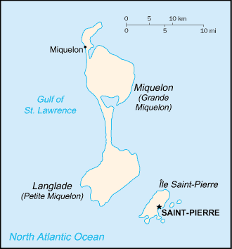
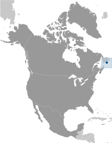
Saint Pierre And Miquelon [ France ] (Overseas Territory):

Advertisement


GPS points near La Ferme du Ruisseau Debons

GPS points from Saint Pierre And Miquelon [ France ] (Overseas Territory)

square Digue Du Large Saint Pierre And Miquelon (general)

square Cap Rouge Saint Pierre And Miquelon (general)

square Deuxieme Etang Saint Pierre And Miquelon (general)

square Tete Du Petit Havre Saint Pierre And Miquelon (general)

square Devalee Du Diable Saint Pierre And Miquelon (general)

square Pointe Quine Saint Pierre And Miquelon (general)

square Etang Des Huit Saint Pierre And Miquelon (general)

square L'ile Aux Chevaux Saint Pierre And Miquelon (general)


viewweather.com sv.ViewWeather.com
fr.ViewWeather.com
da.ViewWeather.com
de.ViewWeather.com
es.ViewWeather.com
www.carpati.org
www.searchromania.net
Deblocari usi
es.getamap.org
fr.getamap.org
de.getamap.org
nl.getamap.org
da.getamap.org
www.getamap.org
Links
Terms of use
Privacy policy

# 0.0666 sec 

contact AT getamap.net

© 2006 - 2024  https://www.getamap.net/